 | |||||||||||||||
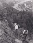
BRILLIANT OVERLOOK TRAIL CONSTRUCTION HISTORYThe idea to develop an easy trail to Brilliant Overlook occurred to me after an outing to the Brilliant Bluffs by the West Kootenay Naturalists turned out to be more of an adventure than was planned as they scrambled over the rugged topography. I proceeded to clear and mark an easy route along the ridge from a point on the old Little McPhee Creek Forest Service Road. As it is open country, it was relatively easy work and I marked the route with flagging tape and paint markings (International Orange) on rocks. Once laid out in the early 1990's, the trail was improved in 1993 by volunteers of the Selkirk College Environment & Outdoors Club. Late in the year, a hand-painted sign was installed at the original trail-head, which is now known as the Lower Trail-head.
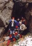
Discussions with Wendy Hurst of the Kootenay Mountaineering Club led me to pursue the notion of seeking out a route from the Brilliant Overlook Ridge down towards Little McPhee Creek and then back to connect to the old ski trails behind the Castlegar Golf Course, and possibly some time in the future to run a trail from this point to the top of Dove Hill. This so called "Connector Trail" took some work to implement; however a combined exploratory party (Selkirk E & O Club and Kootenay Mountaineering Club), on Easter Friday 1994, flagged a provisional route for a part of it. With student members of the E & O Club, Peter Wood and I put in some time in cutting a route over the rugged terrain. To avoid traversing a large talus field we sought out a passable route above it, and this was found along a narrow vegetated strip directly at the foot of the cliffs. Once the cliffs were bypassed, the original route climbed aggressively by means of several switchbacks to reach the Brilliant Overlook Ridge. Additional improvements were carried out by volunteers from the two clubs. In the fall of 1994 I did a presentation to the Friends of Parks and Trails Society in which I outlined the work that had been done over the years. Improvements to the trail continued in the summer of 1995, again with the help of student volunteers. In December of that year I discovered that B.C. Tel Mobility was planning to instal a cell tower on the summit of the ridge and to construct a service road to it. Discussions with Jerome Hango, who had surveyed the route, confirmed my suspicions that the road would obliterate much of the trail and result in other unfavourable changes to the visual landscape. I wrote a letter of objection and prepared a photographic display of the work we had done. In response to this presentation and similar concerns which were voiced by representatives of the Kootenay Mountaineering Club at a meeting held in Castlegar, the proponent changed the application to accommodate our concerns. Plans for the road were abandoned and the cell tower was constructed entirely by helicopter and a helipad was built at the site for future maintenance. A ground cable was laid in place of what would have been a highly visible powerline supplying power to the site.
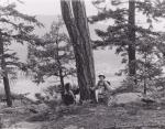
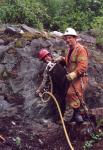
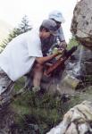
From 1995 onward I was working within the Friends of Parks and Trails Society, and other projects kept me fully occupied. In 1999, however, I was able to obtain a grant from Columbia Power Corporation to do major improvements to the Brilliant Overlook Trail, and I refocused my attention on this project. I hired Wade Stoochnoff who took on this demanding job with great enthusiasm. We reworked most of the old route; however, I had decided earlier to abandon the switchbacks in favour of a longer but far gentler route which would run to the brink of Little McPhee Creek and then turn back to eventually connect with the old trail just above the switchbacks. In addition to an easier grade, this routing would provide the desirable variation in terrain and vegetation, and also offer several scenic viewpoints. In a level area adjacent to the Upper Viewpoint, the route would run through a lovely stand of stately trees. Wade followed along with his grubbing work, with the uphill walk to the work site getting more demanding with each passing day. We were able to get a helicopter flight to the helipad and used the occasion to fly up the required bench materials as well as camping supplies so we could work from a temporary base at the top. A bench was constructed at the Lower Viewpoint from components flown in, and two benches were constructed at the Upper Viewpoint from materials available nearby. In the summer of 1999 I also started working closely with Columbia Power Corporation in an effort to mitigate the effects of the projected Keenlyside Transmission Line on the Kootenay River trails, especially Brilliant Overlook Trail. Many of my suggestions were adopted at considerable expense, but with the result being a gentler impact by the project on the landscape. To save the lovely fir grove at the Skattebo Reach-Brilliant Overlook Junction, the line was moved upstream into the natural clearing which is traversed by the Brilliant Overlook Trail. To preserve the natural flower meadows, the towers were redesigned from wooden poles (which would have required deep holes excavated and blasted into the bedrock with the aid of an air-track drill) to steel towers that could be accommodated on concrete footings. Work for the tower foundations started in the spring of 2001. These, as well as the required anchors, were constructed by a small crew working with a compressor and pneumatic drill which were flown in by helicopter. Likewise, the concrete was delivered by helicopter. I was able to make arrangements with the drilling crew to come on site after the shift was over and use their compressor and pneumatic drill to drill several large holes in the cliff above, where I was planning to construct a catwalk. A couple of volunteers helped me with the difficult drilling.
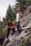
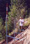
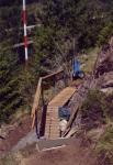
Later that summer I employed Ryan Murphy, and although we jumped around between several jobs, we managed to construct the catwalk. I prefabricated a pipe frame which was attached to pins that were grouted into the previously-drilled holes. Cleated planks were secured to the frame and a handrail was constructed. Concrete steps were poured at the top end of this inclined ramp. Further up this rugged portion of the trail we drilled a number of holes with a Hilti drill to accept steel anchors which formed supports for a set of hand-cables. A small bench was secured to a vertical rock face at the top end of this challenging trail segment; it offers a scenic spot for a well-deserved rest. In the summer of the same year I discovered that Telus Mobility had a contractor cut down several trees around the helipad; these were left scattered along the trail and created an eyesore as well as a serious fire-hazard for their structure. I quickly convinced a company representative that it would be wise to clean this up, and Ryan and I spent a weekend camped on the helipad attending to the fires which were necessary for the cleanup. We also constructed a new trail from a junction point on the ridge trail so that the new trail runs to what is now known as the Upper Trail-head on the new Forest Service Road. The old trail, which connects to the Lower Trail-head on the old Forest Service Road was cleared of debris and re-routed through the wide powerline corridor by means of marker posts. As part of the mitigation for the powerline impacts, new signs were installed at all the trail-heads.
As this work was concluding, other challenges arose. There were threatened impacts from the construction of the new 230 kV line and the Brilliant Substation by Aquila Networks Canada (now Fortis BC). Initially, the line was projected to run right across the Brilliant Ridge to the proposed Substation directly below, passing right over the Vice. A field meeting with Kevin Megale and Rick Chmielewski quickly led to a decision to amend this proposal, and to seek accommodation for their line in the Columbia Power Corporation corridor. Eventually, both corporations reached an agreement which reduced the width of the required clearing by adopting a narrow configuration for the line placement. Columbia Power Corporation also committed to a 5 year (instead of 10 year) maintenance cycle in the area near the Kootenay River span towers. This will allow the retention of taller trees under the powerline before they need to be cut. The Friends of Parks and Trails Society received a compensation payment of $ 25,000 from Aquila Networks Canada which is to be spent on further improvements to the Kootenay River trails. In conjunction with other work funded by the Brilliant Expansion Project Corporation in 2003, distance markers were installed along Brilliant Overlook Trail every 500 meters, starting at the Skattebo Reach Trail-head. New advisory signs were also produced and installed. Records indicate that Brilliant Overlook is the most favoured hiking destination from among the assortment of trails which make up the Kootenay River Trail System. It has undergone many changes over the years. The final link in the old vision of the "Connector Trail" to Dove Hill was realized when I completed the Dove Hill Trail Extension in the summer of 2003. This work was funded by the Brilliant Expansion Project Corporation as the first phase of a three year work program designed to improve the trails near the area affected by the construction of the Brilliant Expansion Project.
Chronology & Acknowledgments 1991 Route location, flagging and some clearing. 1993 Work on the ridge trail; installation of trail-head sign (now Lower Trail-head).
1999 Re-construction of Brilliant Overlook Trail with significant re-routing, viewpoint development and bench installation.
Paid crew: Wade Stoochnoff Volunteers: Peter Wood 2001 Construction of catwalk ramp and installation of hand-cables. Debris cleanup near helipad.
Paid crew: Ryan Murphy Volunteers: Peter Wood, Steven Rigby, Jeff Grant
Paid crew: Kyle Levy, Kevin James
Paid crew: Kyle Levy, Justin Dexter, Adam Leavitt, Steven Grant, David Walden | |||||||||||||||
|
All rights reserved. Information is provided for personal use only. Use in any other application without permission is forbidden. |
