 | ||||||||||||
DOUKHOBOR WATERLINE TRAIL CONSTRUCTION HISTORYIn 1999 I decided to look at the parts of the McPhee Waterline which were not used by Skattebo Reach Trail and determine if the waterline bed would be suitable for the development of a trail along the historic structure. Field studies convinced me that the waterline did not head further uphill from the point where Skattebo Reach Trail departed from it (as I expected), but instead took a downhill course to the wooded terrace which it shared with the trail. I established a connection at the point where the two were the shortest distance apart, and started to follow the waterline route towards Little McPhee Creek. This investigation quickly convinced me that the waterline bed was suitable for a trail which could be constructed with minimum disturbance to the remnants.In 2000 I secured funding from Columbia Power Corporation which allowed me - amongst other things - to construct the first segment of this new trail as far as Little McPhee Creek. Gordon Gibson put his RFW students to work as a field exercise and with our combined efforts we managed to do a great job, as the terrain was relatively easy most of the way. A rather superficial examination of the stream bed led to the erroneous conclusion that this creek was the actual source for the diverted water. There appeared to be the remnants of a dam in the creek bed. I became suspicious of this conclusion when I realized that the very low late-summer flows of Little McPhee Creek would not warrant the construction of such a large pipeline. A conversation with Eric Roulancic confirmed my suspicions as he had explored the line further with his father several years earlier.
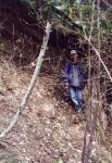
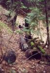
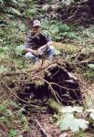
In the spring of 2001 I spent several days in tracing the line further and with the aid of a machete slashing out a passable route. Ryan Murphy helped me in this task. Eventually we worked our way past a couple of major washouts and across a number of rotting trestles to the diversion point quite a distance up Big McPhee Creek. There was evidence of a concrete dam at the diversion point, and - as a surprise - plastic pipe which fed water to a presumed plantation somewhere nearby. A cache of supplies confirmed my suspicion; however, the operation had been abandoned for some time, probably in response to our trail-building activity in the area. I did not attempt to trace the plastic water pipe to its destination. In the summer of 2001 Columbia Power Corporation provided funding which allowed me to hire Ryan Murphy and I proceed with the trail extension. Our initial assessment indicated that the work would be very demanding as the waterline ran a long way into the deeply-incised Big McPhee Creek valley, across steep hillsides and gullies, many of which had been bridged by trestles. Although most of the trestles were rotten, there were some amazingly well-preserved pipe segments in locations where the trestles kept the waterline above ground. I decided to proceed with the work cautiously over several years in order to minimize the disturbance to the structure and to allow the disturbed ground to settle. For safety's sake, the trail was constructed on one side of the buried pipeline, with well-marked cross-over points to the other side when necessary, and where the buried line was filled in. Elk traffic along the newly-opened trail helped us to trace the buried line, as the animals' hooves broke through in between the wire coils. Helping with this work for several days was the Metis Association crew under the direction of the Ministry of Forests (Dave Fitchett). We also constructed a connector trail (McPhee Canyon Trail) which dropped into the McPhee Creek Canyon and joined Skattebo Reach Trail near the bridge. It made the basis for a very popular loop. Several benches were constructed from materials available in the field.
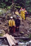
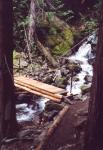
In 2002, with additional funding from Columbia Power Corporation, I hired Kyle Levy and Kevin James and we were able to push the trail all the way to the intake point. The crew accessed the work site daily by using a canoe to the mouth of Little McPhee Creek and then walking uphill on McPhee Canyon Trail, and finally arriving to their destination along the completed portions of the new trail. The trail had to be constructed across several unstable eroded gullies and often log shoulder-supports had to be employed. Small bridges were constructed from available materials where necessary. When I carefully examined the remnants of the intake structures, I decided that there were sufficient items of interest to warrant the development of a short interpretive loop trail, and the trail was constructed with this future development in mind. We were again supported by the Metis Association youth crew working with the Ministry of Forests (Dan Reibin). The youth crew was employed in improving the approaches to the new permanent bridge we were going to construct (the third on Little McPhee Creek), in the construction of the bridge itself, and in the installation of a toilet at the lower end of McPhee Canyon Trail. The bridge itself was constructed from timber found on site (cribbing abutments and stringers). Other materials such as premix concrete, precut decking lumber, pipe rail posts and wheelbarrow were flown to the site by helicopter. In lieu of a wooden handrail, I attached two vertical pipe posts through which a cable was threaded and secured to anchor points in conveniently-located boulders.
A final funding grant by Columbia Power Corporation in 2003 was combined with a payment from the Brilliant Expansion Project Corporation and this larger budget allowed me to hire a larger crew. The predominant focus of our work was the construction of new trails on Dove Hill, as had been proposed for Phase One of the BEPC compensation package. There was, however, also extensive work done on the Doukhobor Waterline Trail. This involved a re-grubbing of much of the trail to repair slumping shoulders and to widen the relatively stable trail bed. The cross-over points were further reinforced by in-filling the buried pipe at those points. To make trail maintenance easier, distances were measured precisely with a hip chain, and distance markers were installed every 500 meters. The locations of problematic features such as potentially unsafe trees and snags were plotted against the distance coordinates on a trail log for maintenance purposes. New signs were produced and installed at the new trail-heads and one was installed at the boundary of the Atco property, as had been requested. Much yet remains to be done. This includes the development of two viewpoints with benches and at least one interpretive sign panel, the development of the interpretive loop along with numbered stops, explanatory signs, and brochure; and the compilation of the relevant history behind this amazing communal achievement. In my negotiations with the Brilliant Expansion Project Corporation for a compensation package, I included a proposal which would see this work completed. Thus, when fully completed, the Doukhobor Waterline Trail will be an important asset in the somewhat limited inventory of properly developed local heritage resources.
Chronology & Acknowledgments 1999 Planning, site studies, flagging and some clearing. 2000 Construction of trail as far as Little McPhee Creek.
Paid crew: Aaron Retzlaff, Matt Luck Volunteers: Gordon Gibson/Len Dunsford and Selkirk College RFW students.
Paid crew: Ryan Murphy
Paid crew: Kyle Levy, Kevin James Volunteers: Peter Wood
Paid crew: Kyle Levy, Justin Dexter, Adam Leavitt, Steven Grant, David Walden | ||||||||||||
|
All rights reserved. Information is provided for personal use only. Use in any other application without permission is forbidden. |
