 | |||||||||||||||||||||
SKATTEBO REACH TRAIL CONSTRUCTION HISTORYThe idea for Skattebo Reach Trail developed partly from a wish expressed by the late John Carter to see the so-called Glade Trail extended to Brilliant. After the completion of the original Brilliant Overlook Trail along the ridge - and the mapping associated with this work - the name Skattebo Reach transposed itself in my imagination from a feature on a topo map to a vision for a new trail. The politics behind attempts to route the Trans Canada Trail through the Kootenay region justified an accelerated plan of construction which would - in conjunction with the Columbia and Western Railway - offer a viable contending route. I felt, with many others, that the "northern option" had far more to offer in terms of easy grades, fantastic scenery, and historical connections than the Dewdney Trail route which was officially adopted. At time of writing (spring 2005), the Trans Canada Trail is being re-routed along the "northern route" from Christina Lake to Castlegar, and then along the Columbia River to Trail.
In the spring of 1997 several field reconnaissance trips were carried out with the help of volunteers and we were able to locate a good portion of the historic Doukhobor workers' trail from Glade to Brilliant Dam. Tradition has it that it was used by workers for travel to the dam project during its construction in the early 1940's. There is also anecdotal evidence that Peter (the Lordly) Verigin had the trail developed during his lifetime so that community members from points east could come to the sobranye meetings at Brilliant without being exposed to the anarchist views of the break-away residents of Thrums, across the Kootenay River. At any rate, much of the trail was located, although it had not been used for many years. I decided not to follow the trail faithfully for practical reasons. Between the Doukhobor Suspension Bridge and Brilliant Dam the historic trail did not exist, and an entirely new - and very challenging - route was laid out through the Brilliant Canyon. Upstream of the Brilliant Dam, the McPhee Creek waterline bed was followed for easy passage under the Brilliant Overlook cliffs in preference to the original workers' trail which started descending at the point now directly under the Keenlyside power-line span. Once past the bluffs, the surveyed route for the new trail left the waterline and proceeded downhill, and then followed a lower terrace before descending via a steeper switchback to re-join the workers' trail in the vicinity of present Mudbog Bridge. From this location, the historic trail was again followed where it could be located until it disappeared into the massive debris field which buried it at Little McPhee Creek. Our trail was flagged to run below the toe of the debris field where a suitable bridge site existed. Between the two McPhee creeks a new route was adopted which runs to the crossing point for the larger creek. Upstream of Big McPhee Creek, our field surveys located the only passable route past an extensive rib of rock and this obstruction effectively put us back on the historic workers' trail which was then followed faithfully to Glade with some minor departures in favour of better ground.
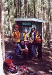
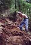
Improvements to the flagged route commenced in the summer of 1997 with a crew of 3 recent Selkirk College graduates (Aaron Shepard, Chris Drake, Jeremy Baxter) and volunteers. At the same time, Columbia Power Corporation was engaged in selective logging on their property above Brilliant Dam, and the STEP Program workers constructed several hundred metres of trail through the affected property and made two benches. The Corporation agreed to save a significant number of large trees along the trail on the basis of my request; unfortunately several were lost to illegal fire-wood cutting. In the autumn of 1997 further work was undertaken by volunteers from the Selkirk College Environment & Outdoors Club, so that by the end of the year, the trail was passable (with some degree of bushwhacking) as far as Little McPhee Creek. As I was not happy with my original trail routing between the existing Mudbog site and Little McPhee Creek, I returned in the spring of 1998 for further terrain studies. As luck would have it, in working my way back uphill after a fruitless search for an improved route, I struck for higher ground and discovered the missing segment of the workers' trail. The realization came to me as my legs were being peppered by the stings of irate yellow-jackets, whose nest was hidden in the rocks below my feet; thus the moment of discovery was doubly memorable. We had a proper route at last. That summer, funding from an anonymous trail-construction donation to Selkirk College was used to pay the veteran team that had worked for me the previous year to build the remainder of the trail. The crew followed the flagged route and constructed a passable trail according to my specifications. I obtained permission from the Doukhobor Historical Society to remove select segments of the waterline wire coil where it was deemed to be a hazard. These were compacted and bundled up for removal later by helicopter.
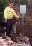
With funding from the B.C. Summer Games Legacy Fund I was able to develop an interpretive panel on Doukhobor history. It was installed on a short side-spur off the main trail which leads to a viewpoint above the Brilliant Suspension Bridge. As bedrock in this location was just below the surface, a novel method had to be improvised to secure the metal sign frame. This involved drilling holes vertically into the rock and driving into them threaded metal inserts which were grouted into place. Threaded coupling flanges were attached to the embedded rods; these allowed for some degree of adjustment during the assembly of the sign frame members. When assembly was complete, concrete footing pads were poured around the couplers, in essence rendering the installation tamper-proof. The sign panel was brought in with the help of the party on hand for its dedication and was quickly secured to the frame before the photo was taken. Unfortunately, this sign was faulty and I had to take it out later for repairs to the peeling paint. Skattebo Reach Trail was officially opened on Sept. 27 1998, with 83 people following me on the walk to Glade. In the fall of 1998 I started preparatory work for the two bridges which were to be constructed the following year. A team consisting primarily of volunteers prepared the two bridge sites by first constructing access trails to them from the Kootenay River, and then starting work on abutments for the bridges. Materials available on site were used to construct the required timber cribbings. Several stringers were secured into place, so that by the close of the working season, both creeks were passable by means of provisional bridges.
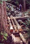
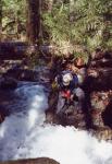
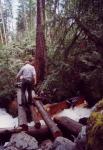
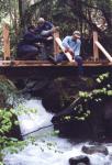
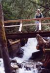
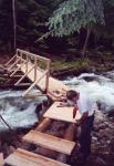
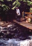
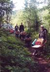
In 1999 I had one worker (Wade Stoochnoff) working on Brilliant Overlook Trail, and two members of my original construction crew (Aaron Shepard and Chris Drake) were working on the Columbia River Trail under the direction of John Mansbridge. I decided to push ahead with the completion of the bridges across the two McPhee creeks even though I could get no additional funding for this work. Thus it was done almost entirely by volunteers, with all the required lumber generously donated by Kalesnikoff Lumber. In addition to work on the bridges, a bench was erected at the rock-slide viewpoint from prefabricated components and premix concrete delivered to the site in wheelbarrows. In the same year, the waterfront lots along the Kootenay River between Big McPhee and Glade creeks were turned over to Selkirk College for management, and the property became known as the Skattebo Forest. As Columbia Power Corporation owned almost all the remaining property between the Brilliant Trail-head and Big McPhee Creek, the long-term commitment for the support of Skattebo Reach Trail by both parties was now in place. The first bridge to be completed was at Little McPhee Creek. Sufficient seasoned lumber was available in the debris field to construct log cribbing abutments and to put three stout stringers into place; this work had been completed in the previous year. The next priority was to construct a concrete retaining wall which would protect the vulnerable north abutment from the current. To achieve this, volunteers (notably Peter Wood and his South Slocan Scouts) helped in packing supplies which had been brought in by canoe and had to be carried up a very steep trail to the higher bridge location. Supplies thus packed in included a generator, Hilti drill, and over 3000 lbs. of premix concrete. Wade Stoochnoff was temporarily diverted from Brilliant Overlook to help in the most challenging tasks. To secure the concrete wall to the bedrock I drilled many holes to accept rebar as well as threaded anchors which would support the wooden form. Pouring the wall was a race against the steadily rising water, but we managed to pull it off. The wall was topped off by a log cap and the space behind it was filled with rock and soil. We left the bridge in a passable condition and shifted our attention to Big McPhee Creek.
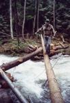
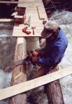
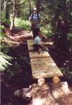
Again, supplies came in by water to a landing at the mouth of the creek. Some preparatory work had been done in the fall of 1998. I had decided to use a large rock for the south abutment and to construct a log cribbing for the north abutment. A cedar tree had been felled across the creek and winched into place on the previously constructed abutment which had been secured to the stump of the sacrificed tree. Thus installed, the first stringer provided a usable provisional bridge late in the year. New work now commenced in the spring of 1999 with the act of securing the stringer properly to the rounded rock surface; this was accomplished by drilling anchor holes for steel pins and pouring a concrete bearing pad over the rock. The stringer was then secured to an embedded metal bracket. A second tree was felled across the creek from the opposite shore, de-limbed, and winched into position across the first stringer. It was similarly secured and trimmed to provide a better walking surface. Once I obtained the decking lumber, I precut it all at my home workshop and delivered it to the bridge locations. Both bridges were decked as one continuous operation; this required selective trimming and shimming of the stringers. Every 4 feet or so, longer decking planks were used, which accepted the vertical rail posts. These were attached by sturdy angle brackets I had prefabricated earlier, and diagonal braces were put in place. The horizontal components of the railing were then attached. At Big McPhee Creek, a secondary ramp across an overflow channel was constructed, using stringers from a nearby blow-down. Later finishing work at this bridge involved the placement of a gabion on the north side, the construction of a protective rock wall on the south side, and the installation of a bench above the gabion.
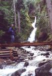
In 2000 I obtained a grant for the Friends of Parks and Trails Society from Columbia Power Corporation which allowed me to pursue additional work. We constructed a short spur trail to the Little McPhee Creek waterfall and a second bridge on this creek was built just below the waterfall. We also started developing a spur trail along the Doukhobor waterline to Little McPhee Creek; this later became the first segment of the much-longer Doukhobor Waterline Trail to Big McPhee Creek. The grant also supported a massive clean-up effort on the terrace above Big McPhee Creek; this improved the aesthetics of the site and reduced the fire hazard. Several benches were constructed from field materials. With additional volunteer assistance I constructed a small bridge across the Mudbog in a one-day operation which was based on a four-wheelbarrow-transport for the delivery of all materials, tools and prefabricated components to the site. Footings were poured, stringers were located, prepared and installed, and the bridge was decked before we set off for home with the much-lighter wheelbarrows. During the next two years, my work was focused on the Doukhobor Waterline Trail; however we were able to do selective improvements to the main feeder trail (Skattebo Reach). To make an attractive loop walk possible, I decided to survey and construct a steep trail which drops from the Doukhobor Waterline Trail and by means of several switchbacks runs to the brink of Big McPhee Creek Canyon, which it follows to its junction with Skattebo Reach Trail. A toilet was flown in and installed on the previously-cleared terrace above Big McPhee Creek. In conjunction with the helicopter delivery of the toilet, the waterline wire coil bundles were removed from six site locations in 900 lb. lifts and deposited into the metal recycling bin below Brilliant Dam. A failing segment of the trail across a steep rocky gully was stabilized by installing rock anchors and constructing a low rock wall. In 2002 I was successful in getting a $1,500 grant from Regional District Area J which allowed me to develop a brochure on the Kootenay River trails. Two types were produced: 200 copies of a full-colour version for distribution to Society members, and 500 black-white copies for general promotion. Later I obtained permission from Director Pellerine to use a part of the remaining funding to launch the Society website and the Kootenay River trails map was further refined to include image links for the interactive website version. I worked together with Doug Fellman (MInistry of Forests) on the preparation of all three map versions.
In 2003 the Brilliant Canyon segment of the trail was closed for the construction of the Brilliant Expansion Project and the Access Road to the site. This work resulted in devastating impacts on the trail for which I was able to negotiate a $ 39,000 compensation settlement on behalf of the Friends of Parks and Trails Society. The trail was to be reconstructed at contractor expense after project completion and the compensatory funding was to cover the costs of new trail construction (Dove Hill Trail extension), as well as improvements and enhancements to existing trails near the affected area over a three year period. A previously-obtained compensatory payment of $ 25,000 from Aquila Networks Canada had been similarly negotiated as mitigation for the residual effects from the construction of the new 230kV lines and the Brilliant Substation on the Kootenay River Trail System. In addition to these payments which will fund future trail improvements, significant amendments had been made to the line routing and to the Kootenay River span design to address concerns raised by me. With all these factors in place, the future status of Skattebo Reach Trail as a high-value interpretive trail is assured. Chronology & Acknowledgments 1997 Planning, site studies, flagging and some clearing; commencement of trail construction with volunteers.
Paid crew: Aaron Shepard, Chris Drake, Jeremy Baxter Volunteers: Selkirk College Environment & Outdoors Club: Peter Wood, Tomas Ersson; Steven Rigby, J. Shuepfer; Gordon Gibson/Len Dunsford and Selkirk College RFW students
Paid crew: Aaron Shepard, Chris Drake, Jeremy Baxter Volunteers: Ken Cazakoff, John Cazakoff, Steven Rigby, Pat West, Peter Wood Official opening on Sept. 27 1998.
Paid crew: Wade Stoochnoff, Steven Rigby, Pat West Volunteers: Chad Voykin, Ryan Murphy; Peter Wood and the Scouts of South Slocan; Gordon Gibson/Len Dunsford and Selkirk College RFW students.
Paid crew: Aaron Retzlaff, Matt Luck Volunteers: Peter Wood; Gordon Gibson/Len Dunsford and Selkirk College RFW students.
Paid crew: Ryan Murphy Volunteers: Peter Wood
Paid crew: Kyle Levy, Kevin James Volunteers: Peter Wood
Paid crew: Kyle Levy, Justin Dexter, Adam Leavitt, Steven Grant, David Walden | |||||||||||||||||||||
|
All rights reserved. Information is provided for personal use only. Use in any other application without permission is forbidden. |
