 |
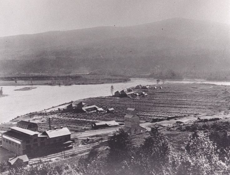
| This view is towards the confluence of the Kootenay and Columbia rivers, where the Lower Landing was located temporarily from 1895 to 1897. A spur track veered off from the switchyard behind the Brilliant station-house (built later, seen in the lower left of this photo), and ran down the edge of the escarpment to the lower terrace. Remnants of the grade can be seen where it winds its way down at the centre of the extreme right edge of the photo, and a dark smudge cutting across a gully to the left indicates where the gully was filled in for the grade. The Doukhobor community of Brilliant is seen at the height of its development. (1920's). |
|
