
SENTINEL SLOG TRAIL
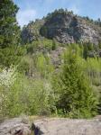
This trail offers one of the more difficult ways to get to the top of Sentinel Mountain; however, it is by far the most scenic. It was built by a very capable team of local volunteers with great dedication and little fanfare. The trail picks its way from the lower terraces locally known as Indian Flats, through choice wild-flower beds (especially colourful in the spring) and then launches a serious attack on the cragged southern face of the mountain. Here it climbs aggressively with continuous grades which would merit an approval rating from KMC veteran Bob Dean.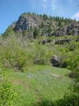 |
 |
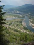 |
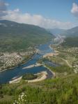
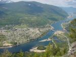
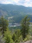
Generally, the route it follows is upstream in relation to the Columbia River, displayed in all its glory almost directly below. A few minor switchbacks complicate the general trend to bring the trail around obstructions such as impassable rock outcrops. Eventually, when about halfway up, the trail abruptly reverses direction and after a short and steep run through an open forest, it attains the south-east ridge, directly above the prominent streaked cliffs which make up the brow of the mountain. There are fabulous views throughout, of course, especially of Waldie Island, and Castlegar. Once the ridge is attained, views open up into the Kootenay River valley. The hike along the ridge is considerably easier and the trail runs onto the road that runs partly around the perimeter of the small plateau from which the final top protrudes. Turn left onto the road and follow it about 300 meters to the viewpoint for a well-deserved lunch. If you wish to reach the actual top, follow the perimeter road back past the trail entry point to the first prominent spur road to the left. This leads to the Keenlyside powerline corridor and beyond it, to the steep ascent to the old fire lookout location.
 |
 |
 |
To access the trail-head, drive a short distance up Terrace Road toward the Verigin Tomb. Park just before the first driveway on the right, and walk up the dug-up road on your left until you hit the terrace. Here bear a bit to your right and head for the natural gas pipeline which can be seen in the distance as a rough road that descends from a higher terrace. The trail-head is well marked and starts about two thirds of the way up the hill. Be prepared for a good workout, and in the summer, a hot hike. Good boots, strong knees, and healthy lungs are prerequisites. As there are a couple of places where carelessness could be painfully costly, be careful. Keep children close at hand at all times. Take care not to dislodge rocks, as there may be people hiking below.
All rights reserved. Information is provided for personal use only. Use in any other application without permission is forbidden.