
SKATTEBO REACH TRAIL
I developed Skattebo Reach Trail through the Friends of Parks and Trails Society once the concept was approved by Columbia Power Corporation, as the company owns the land adjacent to Brilliant Dam and its reservoir. The initial funding grant for roughing out the trail to Glade came from Selkirk College via an anonymous donation. Subsequently; I was successful in obtaining several grants from Columbia Power Corporation and other sources which allowed trail improvements and amenities such as bridges, benches, interpretive signs and brochures. For the complete account of the project development and the appropriate acknowledgments, see Skattebo Reach Trail Construction History.This walking trail runs from Brilliant to Glade, a distance of 14 km. It is also a feeder trail to other Kootenay River trails such as the Brilliant Overlook Trail, the Doukhobor Waterline Trail, the McPhee Canyon Trail, and the Little McPhee Waterfall Trail. Skattebo Reach Trail is named after Ole Skattebo, who spent much of his life along the Kootenay River, especially at the Slocan Pool.

|
|
|
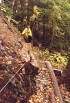
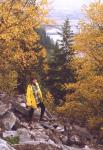
The trail climbs and descends as the rough topography dictates. The most rugged component is through the Brilliant Canyon where the main characteristics are closeness to the turbulent river below Brilliant Dam and the very steep, rugged terrain. In spite of its rough character, many hikers find this segment most attractive. Construction of the Access Road to the Brillant Expansion Project has modified this trail segment considerably, and it remained closed until 2008. The trail was reconstructed by the contractor along a route I worked out with Mats Alexanderson. It drops a bit closer to the river to bypass the toe of a rock storage deposit, and then climbs onto the Access Road near the abandoned catwalk. The original segment between the catwalk and the top of the rock field has been lost and is now replaced by roads that were used during construction of the new Brilliant Plant. The two photographs above are reminders of the trail segment which no longer exists. My interactive trail map shows the the trail as originally built because these changes are minor as shown on the map and the photo links to the lost trail are thus maintained.
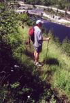
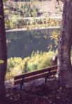
The trail emerges from the canyon onto the Golf Course terrace directly above Brilliant Dam. At this point it picks up the McPhee Creek waterline, which it roughly follows for about 1 km. Soon the trail is squeezed against the Brilliant Overlook bluffs, under which it runs after it leaves the junction with Brilliant Overlook Trail. As the bluffs are approached, the hiker passes under the 1.7 km. long Kootenay River span of the Keenlyside transmission line. A bench is located in a small cluster of cottonwood trees which provide welcome shade in the summer.
|
|

|
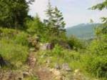
Soon the trail leaves the waterline and starts to descend over open ground, eventually running onto a pleasant terrace which is forested with deciduous and evergreen trees, including some prize specimens. Here the Doukhobor Waterline Trail returns the interested hiker to the waterline which can be followed to McPhee Creek. Skattebo Reach Trail now leaves the wooded bench and descends further to cross a small creek by means of a bridge. Additional descent brings the hiker to the junction with the short Little McPhee Waterfall Trail, which leads to a bridge across the creek and the scenic waterfall itself.
|

|
|
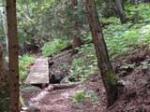
The main trail crosses Little McPhee Creek with a sturdy bridge which was built in 1999. All the materials for this bridge, including over a ton of concrete mix, had to be back-packed uphill from a boat landing on the Kootenay River. The trail runs at the toe end of a huge debris field which resulted from a catastrophic debris flow in recent history. Between the two McPhee creeks the trail descends only moderately and comes within sight of the river again. Here, a spur trail leaves to connect with the McPhee Canyon Trail. Several benches have been placed along this short and scenic loop trail which provide a welcome rest for tired feet.
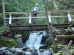
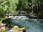
Just before descending to Big McPhee Creek, the main trail connects with the Lower McPhee Canyon Trail-head; this trail can be followed uphill to the Doukhobor Waterline Trail. The creek is crossed by a bridge which incorporates an angled approach ramp. A bench has been installed above the gabion on the north side of the creek. A small spur trail leads to the mouth of the creek and open views of the Kootenay River.
|

|
|
After crossing the creek, the trail climbs to a small terrace from which it descends steeply to almost the level of the river in order to bypass an extensive rib of rock. Soon it starts to climb again to reach the second high spot along the route; from here it descends again onto much easier ground which is generally far less steep and rugged than the previous section. Several small creeks are crossed and after one final climb, the trail ends at the parking area south of Glade. A back-country road leads into Glade.
The trail segment north of Big McPhee Creek runs through the Skattebo Forest, managed by Selkirk College. Plans are under way to develop interpretive signage which will focus on the history and ecology of this area. Also under consideration is an extension of Skattebo Reach Trail from the existing parking area along the Kootenay River to Glade Creek.
A one way trip along the entire trail would require 3 to 4 hours. An alternative option is to walk only as far as Big McPhee Creek and using the Doukhobor Waterline Trail and McPhee Canyon Trail as components of a loop to return back to the Brilliant trail-head. With a stop for lunch, this return trip would require 4 to 5 hours. Most of the trail is not suitable for bicycles.
All rights reserved. Information is provided for personal use only. Use in any other application without permission is forbidden.