 | ||||||||||||
BRILLIANT OVERLOOK TRAILWork on Brilliant Overlook Trail started in the early 1990's when I tried to involve student and faculty members of the Selkirk College Environment and Outdoors Club in trail building projects. The trail evolved over several years from an easy trail along the top of Brilliant Overlook Ridge to a much more challenging ascent trail to the ridge from a junction point with Skattebo Reach Trail, directly below the Overlook. The latter work was done through the Friends of Parks and Trails Society with additional funding grants I was able to obtain from Columbia Power Corporation. For the complete account of the project development and the appropriate acknowledgments, see Brilliant Overlook Trail Construction History.
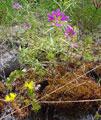
There are three trail-heads. The lowest is at the Skattebo Reach Junction (elevation 584 m.), just upstream of the Brilliant Dam. The other two trail-heads are on the old and new Little McPhee Creek Forest Service roads. From Skattebo Reach Junction, the trail climbs onto a small wildflower meadow which lies directly under the Keenlyside transmission line; from there it starts to climb more aggressively over steep rocky terrain. A catwalk and concrete stairway provide an easy route over a steep rock face and hand-cables provide additional security on the next segments of trail. A bench is located at the upper end of the hand-cabled trail sector.
The trail now enters a rock field which is easily negotiated by following the markers. At the upper end of the rock field, the trail runs directly under the Overlook cliffs along a narrow vegetated strip. Beyond the cliffs the trail ascends gradually through a mixed forest to emerge at the Lower Viewpoint above Little McPhee Creek (elevation 772 m.). There it turns and starts to climb more aggressively again until it emerges in a natural clearing which leads to a small stand of mature forest with impressive old trees. A short side trail leads to the Upper Viewpoint. The trail continues climbing until it reaches the Brilliant Overlook Junction.
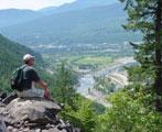
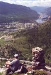
From there, one can follow the original Ridge Trail west across two ravines to the Overlook (elevation 915m.) which offers spectacular views of the Columbia and Kootenay valleys. A short side trail near the Brilliant Overlook Junction leads to the Vice, an intriguing cleft in the rocks. The Ridge trail can be followed in a southeasterly direction past the microwave tower and the Golf Course Viewpoint to the two trail-heads on the forest service roads. The Lower Trail-Head ends on the abandoned forest service road which can be followed down and used in combination with the new road to descend to the Golf Course. The Upper Trail-Head is reached by a separate spur of the trail; it is located on the new forest service road and is suitable for hikers who can drive up and hike the trails in the opposite direction.
Users of the Brilliant Overlook Trail have to take into account the steep and rugged terrain and the hazards that go with it. Some trail segments run close to steep drop-offs and other segments run below cliffs. Objects thrown from the Overlook pose a hazard to people on the trail below. There is also a risk of natural rock fall, especially in the early spring. The sunny open areas along the Overlook Ridge are populated by wood ticks in spring and early summer so a rigorous self examination after the hike is recommended. The trail is closed to bicycles, horses and motor bikes. Hiking distance from Skattebo Reach Junction to the Overlook is 2.7 km., with an additional 2 km. on Skattebo Reach Trail from its trail-head near the Doukhobor suspension bridge. Total elevation gain is about 500 meters. Allow 2 1/2 hours to the Overlook or 4 hours for a round trip. | ||||||||||||
|
All rights reserved. Information is provided for personal use only. Use in any other application without permission is forbidden. |


