COLUMBIA & WESTERN RAILWAY (BOUNDARY RAIL TRAIL)
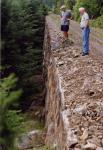
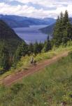
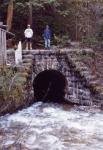
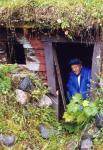
The Columbia and Western Railway was built between Robson West (now Castlegar) and Midway by the CPR at the end of the 19th Century, in a bold move to secure the anticipated Boundary district mining revenue for Canada. (See Railroad From Nowhere to Nowhere) The line was constructed to a magnificent standard, with finely-crafted quarried stone culverts, retaining walls and bridge abutments. Several massive steel trestles span deep ravines and massive stone retaining walls secure the railbed to the precipitous terrain. There is a sequence of short tunnels which culminates at the entrance to the impressive 912 meter Bull Dog Tunnel, where the railway abruptly turns away from the lovely Lower Arrow Lake valley. Old switchbacks in the vicinity of the tunnel trace out the provisional railway over the mountain spur during tunnel construction. The summit of the grade is at Farron; from here the railway starts its descent to Christina Lake, passing by the Verigin Bomb Monument and under the impressive Paulson highway bridge.The C & W railgrade between Christina Lake and Castlegar is being developed by Tourism BC as a world-class recreational trail, and recently the Trans Canada Trail Society has adopted it as the official TCT route, in preference to the Dewdney Trail segment between Christina Lake and Trail which had been initially accepted. The TCT follows the balance of the C & W to Midway and from there, the remaining useable segments of the Kettle Valley Railway to Hope. The adoption of the C & W by TCT is a smart but somewhat belated move, as it puts the TCT traffic onto a route which offers better grades, is far more scenic, and has greater historic significance than the Dewdney route. It also opens up opportunities for exploring the historically-rich Slocan and Nelson areas.
 |
 |
 |
Although the original management plan designated the Boundary Rail Trail for non-motorized use (except for maintenance work), a very strong lobby by motorized recreation groups has tried to force a change to the plan. Personally, I prefer its status as a non-motorized linear park, with perhaps some accommodation to guided motorized tours on specific occasions. These would need to be kept to a minimum and access controlled so that this heritage railway is protected from vandalism and developed with the interpretive infrastructure which can make it a world-class tourist destination. I fear that totally unrestricted 24-hour access by motorized traffic would unduly raise the liability risk and compromise the heritage values, as the secluded location of the trail makes it a prime candidate for illegal activities and irresponsible behaviour. As of 2009, this rail trail has been declared totally non-motorized under the Spirit of 2010 logo. However, the new sign at Pass Creek Park does not reflect the reality of current usage of the trail, and hard feelings are bound to persist for quite some time while things get sorted out.
While it was in ownership limbo, the railgrade was maintained by a small but dedicated group of volunteers headed by Harry Killough. The Columbia & Western Society will remain the stewardship group. It would appear to me that their role will be very challenging if they are to stay dedicated to the dual goals of trail maintenance and heritage preservation. Vandalism is a serious problem locally and it seems to be linked to easy access. This may be more of a worry if this very scenic pathway is developed with the appropriate interpretive infrastructure that it so richly deserves.
The rail trail has been upgraded for public use by Tourism BC, with improvements to the rail bed surface, repairs to washout gullies, stabilization of stone culverts, and the installation of decking and railings on trestles. Although the abandoned rail grade has been used for nearly two decades, public presence on the trail has only become fully legal in the last couple of years.
 |
 |
 |
TRANS CANADA TRAIL ROUTING THROUGH CASTLEGAR AND BEYOND
From the end of the rail-trail near the pump-house, a gravel road runs to Keenlyside Dam. From here, the official routing runs across the dam, past the Arrow Lakes Generating Station, and along Broadwater Road through historic Robson. An alternate route is to follow Arrow Lakes Drive directly into Castlegar, past the industrial area dominated by a sawmill and a pulp mill. The Robson route leads directly to Pass Creek Park, the most attractive campsite in the vicinity. From here it is only a short distance to the city centre via the Robson-Castlegar Bridge.From Pass Creek Park, the official route follows Robson Access Road past the community of Brilliant and then via Highway 3A and the Brilliant Bridge across the Kootenay River. On the south side of the river, the route runs left and uphill to the Airport terrace, eventually crosses Highway 3 and then follows Waterloo Road past the abandoned Doukhobor village of Blahodatnoye (Champion Creek) to where it connects with the Columbia Trail.
There are more scenic alternatives for the pedestrian trail user. Waldie Island Trail can be accessed directly from Pass Creek Park (via Waldie Road, across from the park entrance), and followed through an environmental reserve which is also rich in history to West Brilliant. Brilliant Road is then followed to the recently restored Doukhobor Suspension Bridge, now a National Historic Monument, and the centre attraction of Brilliant Bridge Regional Park. I have been commissioned to develop a historical sequence of sign panels dealing with the history of the bridge and the Kootenay River; these will be in place in the fall of 2011. The trail continues from the south end of the bridge, under the highway bridge and ends at the Park and Ride parking lot. A short detour from West Brilliant, via Terrace Road (across Robson Access Road), allows a worthwhile excursion to the Verigin Tomb and the viewpoint for the Brilliant Expansion Project.
There are several trails around Selkirk College that are best accessed via Rosedale Road (just past the Park & Ride), which can be used to work out a more attractive route downstream in close proximity to the Columbia River. The College trail system can also be accessed from Heritage Road (the first spur off Frank Beinder Way); this routing makes a visit to the Doukhobor Museum possible.
A hiker not overly-committed to following the official TCT route may wish to depart from it in favour of the historically-richer ground traversed by the Kootenay River trails, of which the main trail running east is Skattebo Reach Trail. It starts above the Doukhobor Suspension Bridge and runs upstream along the Kootenay River to Glade. The initial segment of trail has been greatly affected by the construction of the access road to the Brilliant Expansion Project, and the rebuilt trail to the point above Brilliant Dam is somewhat rugged and utilizes parts of the construction roads that displaced the original trail. Although rugged, it offers scenic views and is rewarding for the ambitious hiker. An easier approach is to enter Skattebo Reach Trail from the parking lot near the Brilliant Substation (directly above Brilliant Dam). This can be reached by following the road to the Castlegar Golf Course and taking the first gravel road departing from the paved road to the right (part way up the hill). Directional signs lead to the parking area and trail directly west of the Brilliant Substation.
From Glade, the Ward's Ferry Trail takes the hiker to a segment of logging road, which runs downhill to connect with the paved Blewitt Road; this can be followed to Granite Road that leads into the lovely Queen City of Nelson. The TCT from Salmo can be accessed at Mountain Station. It appears that currently the favoured TCT routing eastward is to follow Highway 3A along the West Arm of Kootenay Lake, across the free ferry to Kootenay Bay and then south along the highway to Gray Creek. A good gravel road runs through Gray Creek Pass to Redding Creek and the St.Mary River. From St.Mary Lake, a paved road can be followed directly to Cranbrook via Marysville and Wycliffe, or a less busy gravel logging road can be used on the other side of St.Mary River. This routing rejoins the original TCT near the Railway Museum. The original routing which followed the Dewdney Trail from Christina Lake to Trail, to the Pend d'Oreille valley, to Salmo, to Lost Creek Pass, to Creston, and to Cranbrook seems to be losing favour and most of these segments are being replaced by more direct travel pathways that offer nicer scenery and vastly superior opportunities to savour regional history.
A further possibility is to follow the Slocan rail-trail from South Slocan (reached by crossing the Kootenay River on the Glade Ferry and heading toward Nelson) to Slocan City. From here, a paved highway is followed north to New Denver and then east through a landscape which has been imprinted by remnants of competing railways, mines, and ghost towns. At the historic city of Kaslo, a visit to the rebuilt sternwheeler Moyie is a must for the history buff. The tour then heads south, past Ainsworth Hot Springs, to the Kootenay Lake ferry at Balfour. This is a very round-about route, but well worth the extra effort. It is advised for the seasoned traveler with time on his hands.
All rights reserved. Information is provided for personal use only. Use in any other application without permission is forbidden.