
WALDIE ISLAND TRAIL
* Please note:Waldie Island Trail no longer exists as it was during my management. Work on the sewage lagoons in 2014 led to significant tree removal and the displacement of the trail to lower ground. A service road built around the berms is now behind a fence, which could have been rebuilt in its original location at the foot of the berms. The service road would have been just as useable, on the rare occasions it was needed, had it been left as a space shared with the public.
The Waldie boardwalks were removed by the trail society in 2013. As a consequence, most trail traffic gravitates to the environmentally-sensitive open beaches, including those around Waldie Island. BC Hydro's water management now fluctuates between extremes of low water (which make Waldie Island more accessible) to prolonged periods of very high water (which contribute to the loss of mature cottonwood trees). Although the High Water Boardwalk has been replaced by an elevated pathway, that route is unattractive compared with the original main route as it was provided by the Low Water Boardwalk, which served the public as an attractive walking path most of the year and a boat-accessible observation platform at very high water.
Waldie Island Trail was my first comprehensive trail project and in many ways the most complex. It was constructed in an effort to reclaim the historic heritage of the Columbia River shoreline in the vicinity of Waldie Island, and to develop public sensitivity to the ecological importance of this very special place. In 1996 I had taken a self-funded leave from Selkirk College, and that gave me ample free time to study the terrain, research the relevant history, develop the signs and work on the trail. After its opening in September 1996, the popular trail was refined and upgraded as new funding allowed. For the complete account of the project development and the appropriate acknowledgments, see Waldie Island Trail Construction History.
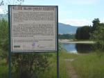
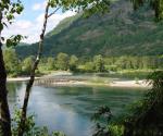
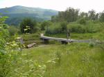
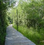
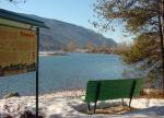
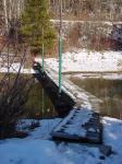
The trail follows the left bank of the river between the CPR Bridge and the community of West Brilliant. (See map). It incorporates many enhancement features such as extensive boardwalks, a 30 metre footbridge, many interpretive signs, and several benches.
|
|
|
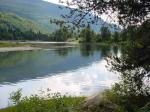
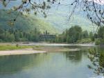
The left bank of the Columbia River between the inflows of Norns (Pass) Creek and Kootenay River is the most important historical site in the Castlegar vicinity. Within this tract of land were located isolated native dwellings, burial sites, as well as an important village near the mouth of the Kootenay. The first steamer landings were along this shoreline and the first government trail was constructed from the upper steamer landing to tap the riches of Toad Mountain. It was here that Albert McCleary ran the first ferry across the Columbia River to join the primitive Colville Trail to the new government trail. The first railway in the district started inching its way towards Nelson over this ground and a bustling - albeit temporary - settlement sprung up in the vicinity. The upstream portion of this tract of land became the Waldie Sawmill, destined to be the longest-lasting early sawmill in our community, while the downstream portion became the centre of the Doukhobor communal enterprise.
|
|
|
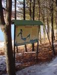
As Waldie Island Trail runs through much of this ground, several of these historic threads have been pursued by means of the interpretive sign panels which are spaced out along the trail. The signs were developed by me with support from agencies, local government and local corporations. They are arranged in a thematic fashion, and most have been expanded into longer website articles written by me, and available here as links to the sign titles. These are:
"A RAILROAD FROM NOWHERE TO NOWHERE"
A study of early railroad development and the growth of C.P.R. influence locally.
"WHISPERS IN THE WIND"
This panel follows the footsteps of early explorers, voyageurs of the fur brigade, adventurers, and missionaries along the Columbia River.
"STEAMSHIPS ON THE COLUMBIA"
Reflections on the period when the river was dominated by the big steamers, starting with the "Forty-Nine" and ending with the last run of the "Minto".
"GROWTH OF LOCAL INDUSTRY"
A look at the history and operation of the Waldie Sawmill, which was an important local employer for half a decade.
"PIONEERS"
The panel examines the way of life followed by the two First Nations which shared the local area for thousands of years: the Lakes Salish (Sinixt) and the Kootenay (Ktunaxa).
"SPROAT'S LANDING"
An essay about the development and demise of this temporary community which occupied the area traversed by the Waldie Island Trail.
|
|
|
In addition to its historical importance, the area traversed by Waldie Island Trail is extremely valuable from an ecological standpoint. Natural regeneration of a good part of the abandoned mill site led to the re-establishment of a complex riparian ecosystem which is characterized by cottonwood trees and smaller shrubs such as hawthorn, willow, and red-osier dogwood. After the extensive hydro development on the Columbia River, such an ecosystem which was once so common, has become relatively rare. Waldie Island itself, as well as nearby Breakwater Island, have become important over-wintering sites for Great Blue Herons, and nesting has been attempted on Waldie Island. For this reason, Waldie Island was acquired by the Nature Trust of British Columbia and is being managed as a heron reserve. Two interpretive panels have been developed which deal with the ecology of this general area. These are:
"NATURE TAKES OVER"
The web of life which developed on the site after the Waldie Mill ceased operation is examined. Highlights of the marshland are signs of beaver activity, and on Waldie Island itself, a transient flock of Great Blue Herons. An interesting feature of the beaver marsh is a 250 metre long beaver canal which the trail crosses by means of a boardwalk.
"THE GREAT BLUE HERON"
A study of the natural history of these magnificent birds and of the importance of Waldie Island and the adjacent areas for their continued presence here, which, hopefully, will culminate in the re-establishment of a viable breeding colony.
|
|
|
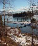
Waldie Island Trail is subject to flooding during high discharge volumes from both Keenlyside and Brilliant dams, and not all segments are accessible at all times of the year. During high water, the flooded boardwalks and the footbridge will float above their concrete footings, being guided by vertical pipe posts. As snow levels close to the river are generally low, the trail is popular at all times of the year. There are many bird-watching opportunities, and an observation platform has been erected which offers a view into the upstream treatment pond. Hikers are reminded that Waldie Island Trail runs through a sensitive environmental reserve, and disturbance to the resident wildlife must be kept to a minimum. The trail has been carefully routed so that it is behind natural vegetative screening. For the protection of resident wildlife (especially the Great Blue Herons, the many vulnerable ground-nesting birds, and egg-laying turtles) dogs must be kept on a leash and confined to the designated trails. Hikers likewise should avoid walking on the open beaches. Waldie Island itself is closed to people and dogs. For reasons of environmental sensitivity, horses, bicycles, and motorized vehicles are not allowed on any part of Waldie Island Trail.
All rights reserved. Information is provided for personal use only. Use in any other application without permission is forbidden.